About the Project
The Site
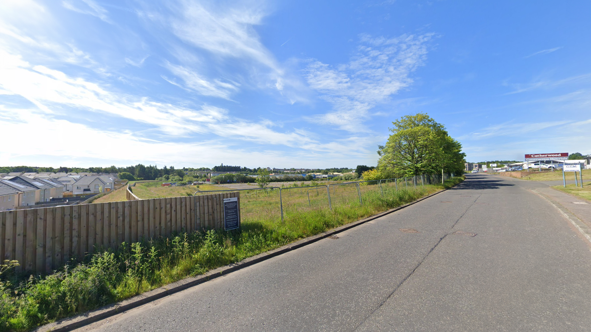
View from northern corner of site
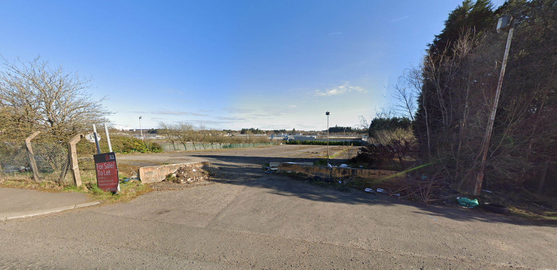
View from northern corner of site
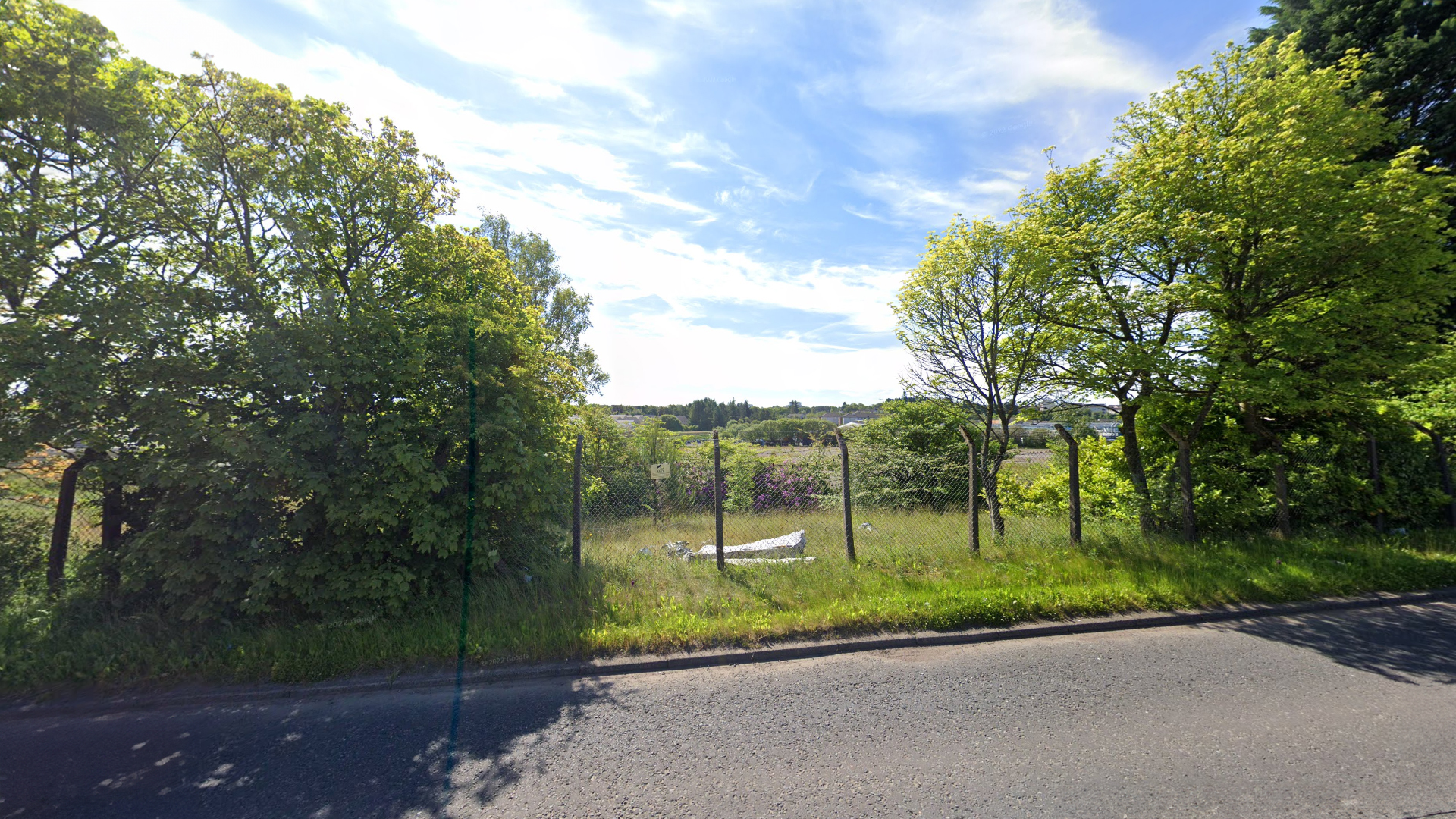
View of site from Law Place
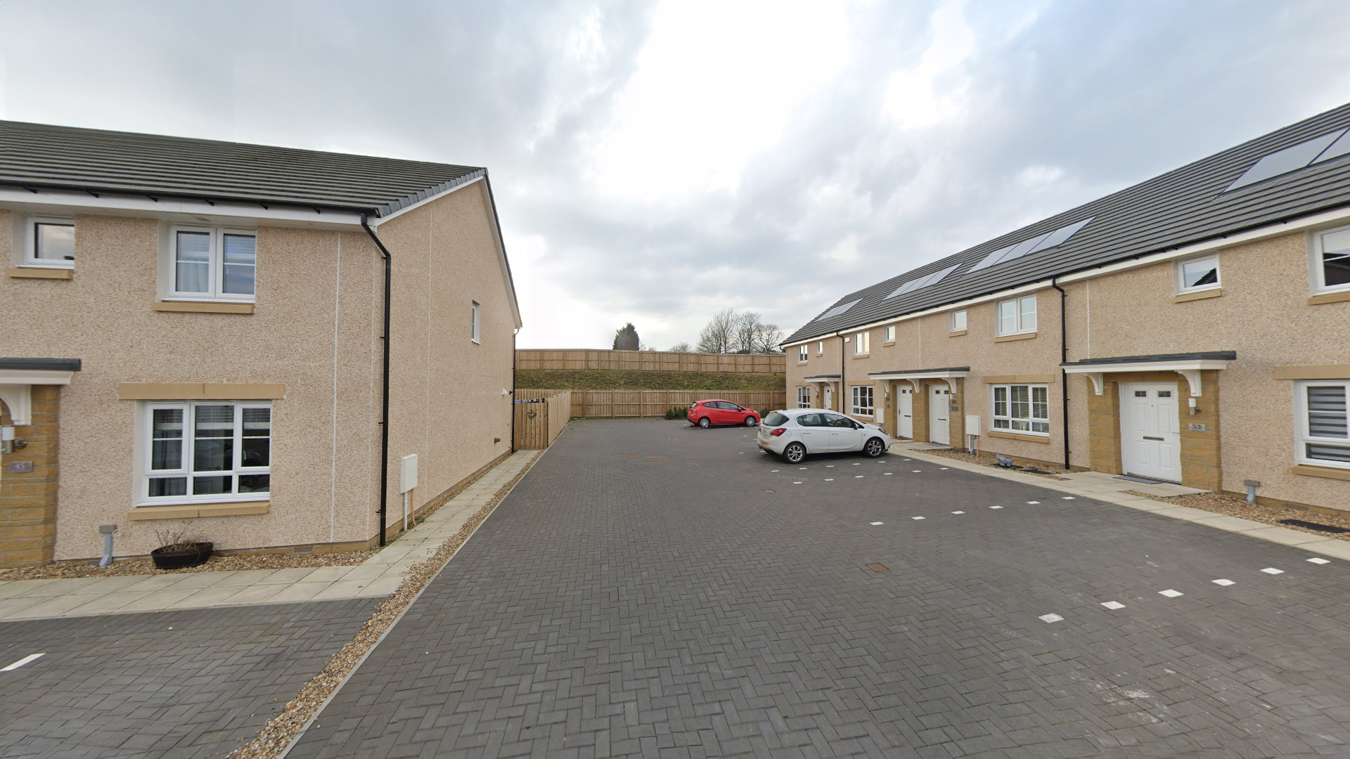
View of north-eastern boundary from existing development
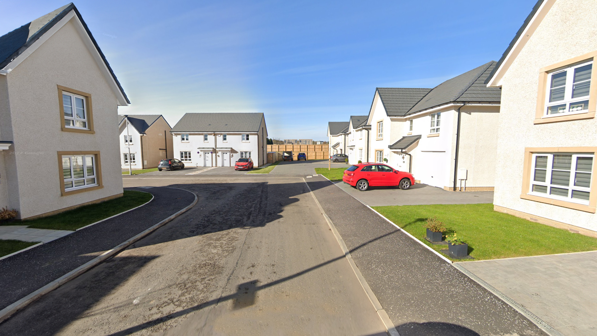
View towards site from existing development to east
The site is brownfield in nature, and extends to an area of c.4.8ha. The site formerly contained a Rolls Royce Plant up until c.2015. At present, the majority of the site is covered by hard-standing, interspersed with small clusters of trees, areas of scrub and pockets of rough grassland.
The site is located directly adjacent to the south of Law Place, and is roughly trapezoid in shape. It is bound to the east by fairly recently completed residential development, which comprises a mixture of detached, semi-detached, terraced and flatted dwellings. To the south lies WestRock – a packaging company and to the west the site is bound by CCF – a building materials supplier. North of the site, beyond Law Place, the site is bound by a number of small scale industrial buildings and their associated yards, including The Advanced Group, A Brown Timber Products and Catherwood Construction Materials and Power Tools UK.
The wider surrounding area is characterised by a mixture of industrial / commercial development within the Nerston Industrial Estate, and a variety of typologies of residential development. Playsport Leisure Centre and Golf Driving Range is located c.175m to the north of the site.
Planning Context
The South Lanarkshire Local Development Plan (‘LDP’), adopted on 9th April 2021 sets out the policies and proposals to guide development in South Lanarkshire.
Within the LDP, the site has no formal land use designation – it was previously covered by a designation as a Core Industrial Business Area, however following an appeal to the Court of Session, the designation of the site was removed from the LDP.
There is a Supporting Planning Guidance and Development Brief for the site, which was published in March 2022, but this supporting guidance is non-statutory, and therefore does not constitute part of the current Development Plan for the site.
Of principle relevance in the LDP, LDP Policy 3: General Urban Area Development and Settlements sets out that ‘Within the urban areas and settlements identified on the proposals map, residential developments on appropriate sites will generally be acceptable.
Proposals for uses that are ancillary to residential areas will be assessed on their individual merits, with particular regard to their effect on the amenity and character of the area.’
Any future planning submission will consider the relevant planning context in further detail, and respond as appropriate to any relevant criteria.
National Planning Framework 4 (‘NPF4’)
NPF4 also forms part of the statutory development plan alongside the LDP, and was adopted on 13th February 2023. The site offers significant opportunity to deliver on the key relevant policies and principles within NPF4, as follows:
- Facilitating the sustainable redevelopment of a long-standing brownfield site;
- Contributing to overarching NPF4 principles through giving due weight to the global climate and nature crises;
- Being designed to adapt to the current and future risks of climate change;
- Contribution towards the restoration and enhancement of biodiversity within the site;
- Creating communities that are inclusive, empowered, resilient and safe;
- Creating places with good quality homes close to local facilities and services by applying the concept of 20-minute neighbourhoods;
- Embedding a commitment to place-making through a design-led approach and focus on quality; and
- Creating places that are distinctive, safe and pleasant, easy to move around, welcoming, nature-positive and resource efficient.
Constraints & Opportunities
There are a number of site constraints and development opportunities which have informed the design of the development from the outset, and these include:
Constraints:
- Existing industrial site to north, south and west and associated noise impact.
- Existing road and industrial buildings to north.
- Brownfield site – ground conditions to be remediated prior to construction works.
- Sloping topography which falls from north to south.
- Existing sewers to south and east.
Opportunities:
- Provide primary vehicular access from north-west of site.
- Creation of landscape buffer to the northern and eastern boundaries of site.
- Provide noise mitigation to the southern and northern boundary of site, to adjacent industrial estates and Law Place.
- Creation of SUDS basin at lowest point on site. This will provide a sustainable long term drainage solution for the development.
- Creation of new housing development on brownfield site which lies within a 20 minute neighbourhood of existing amenities.
- Enhanced biodiversity, reduced hard-standing and improved resilience to flooding.
- New energy efficient family housing.
- Provision of much needed family homes and affordable housing to address national housing emergency.
The Proposed Development

Proposed Site Layout
The proposed site layout has been informed by the existing site constraints and development opportunities set out above. The primary concept for the site is to develop an attractive and welcoming development where families can live and thrive. This will be supplemented by landscaping with enhanced planting along the existing boundaries which will create a sense of place, provide a pleasant back-drop for new homes and improve levels of biodiversity on site.
A SUDS basin will be located within the area of open space to the south-east, providing vital surface water drainage infrastructure at the lowest point of the site. An additional pocket of open space will be formed within the heart of the site which will provide amenity space for new residents. Frontages will be established around the site entrance, onto all streets and lanes and areas of open space.
There is also potential to introduce extensive tree and hedge planting within the development, both along new streets and to front gardens. This will inform soft boundaries between plots and reduce the visual impact of parking from the street.
In terms of housing, the proposal has the potential to include a mix of detached, semi-detached and terraced homes which vary in size between 2 and 4 bedrooms. The site will also accommodate flatted blocks which will back onto the southern boundary – this will form an area of affordable housing.
To help reduce the impact of noise from the existing industrial site to the south and the north, an acoustic fence will be erected to lower acoustic levels into the development. An access track will also be formed along the southern edge to allow for maintenance of the new SUDS basin and existing drainage.
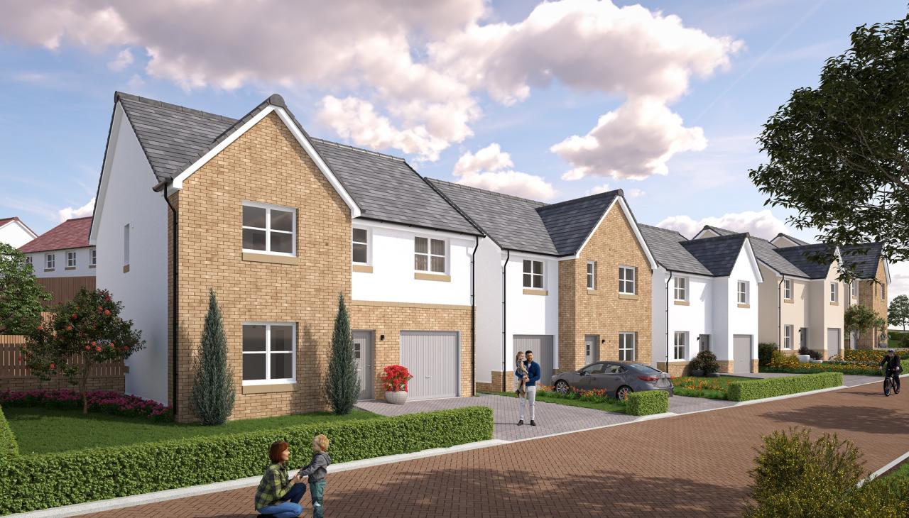
Example Image of Cruden Home development
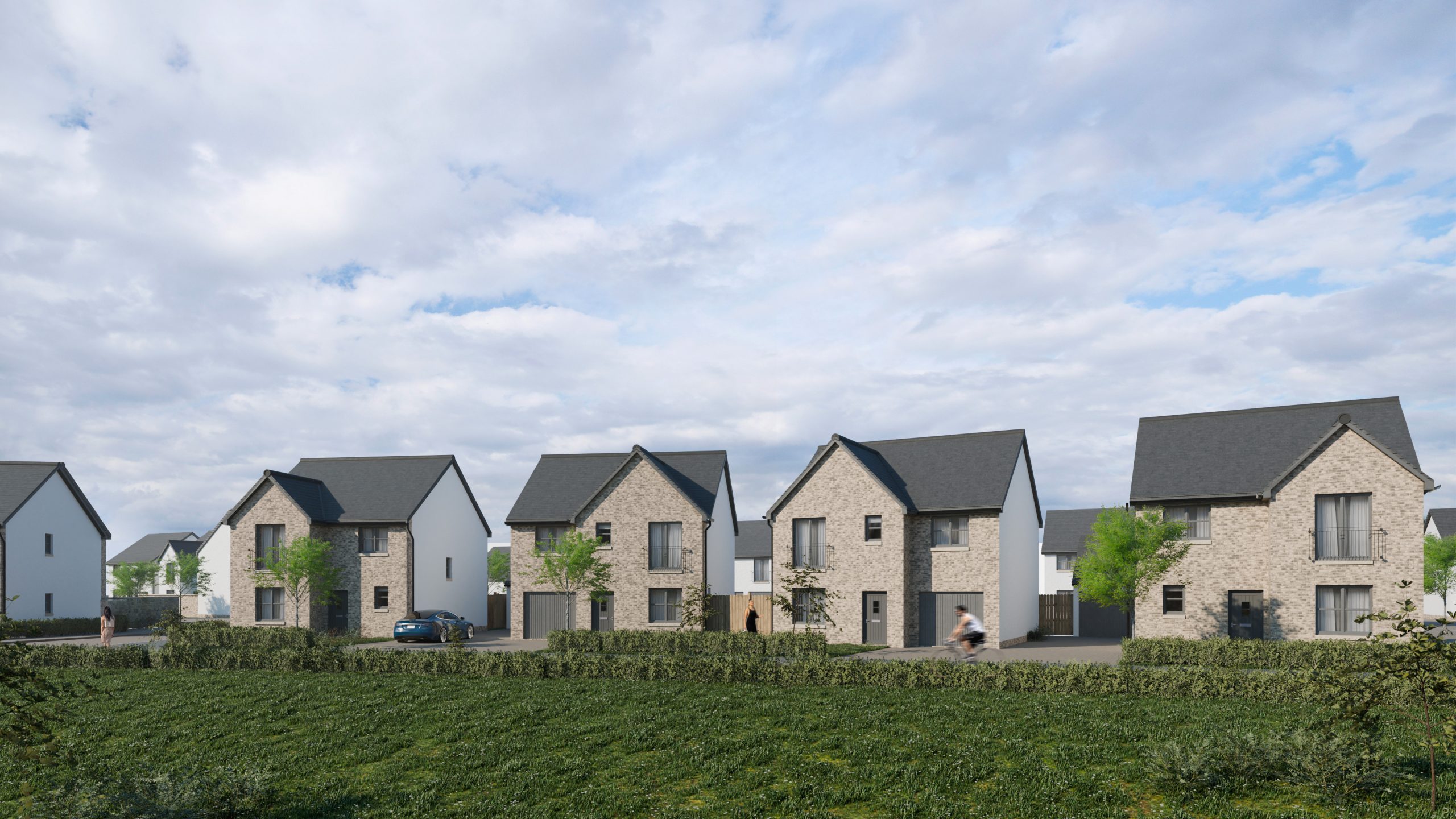
Example image of Cruden Home development
Circulation
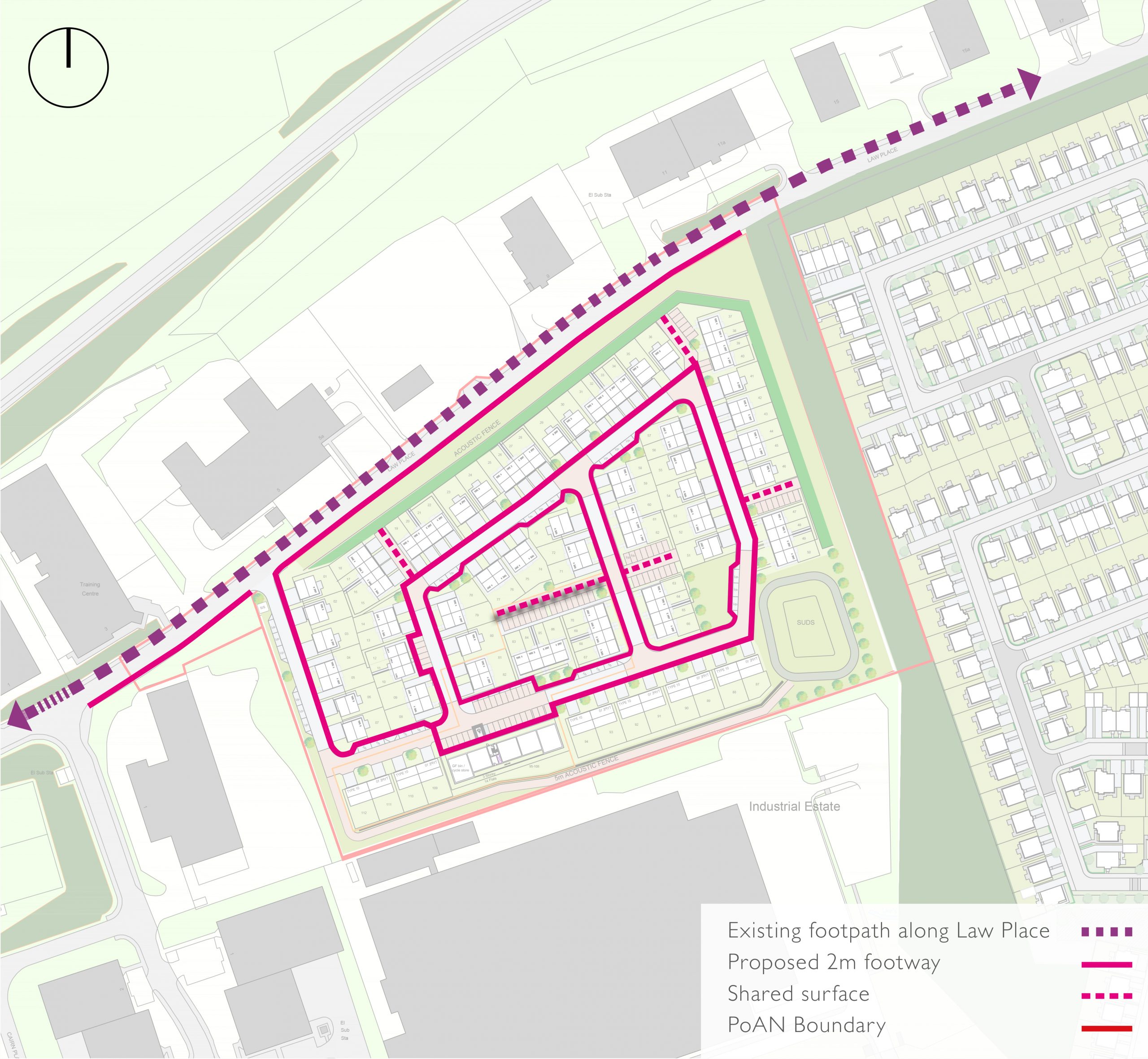
Pedestrian Movement Diagram
Pedestrian Movement
Pedestrian movement will be prioritised throughout the new neighbourhood, with footpath links proposed within the development and connecting to Law Place to the north.
Internally, proposed streets will consist of footways and areas of shared surface which will allow for flexibility of movement. The pedestrian movement strategy also reflects the principles outlined within Designing Streets policy, which identifies that street design should consider pedestrians first, allow for reduced vehicular speeds and connect to the wider network. The layout also responds to the focus of ‘Local Living’ within NPF4, and aims to ‘create connected and compact neighbourhoods where people can meet the majority of their daily needs within a reasonable distance of their home, preferably by walking, wheeling or cycling or using sustainable transport options.’
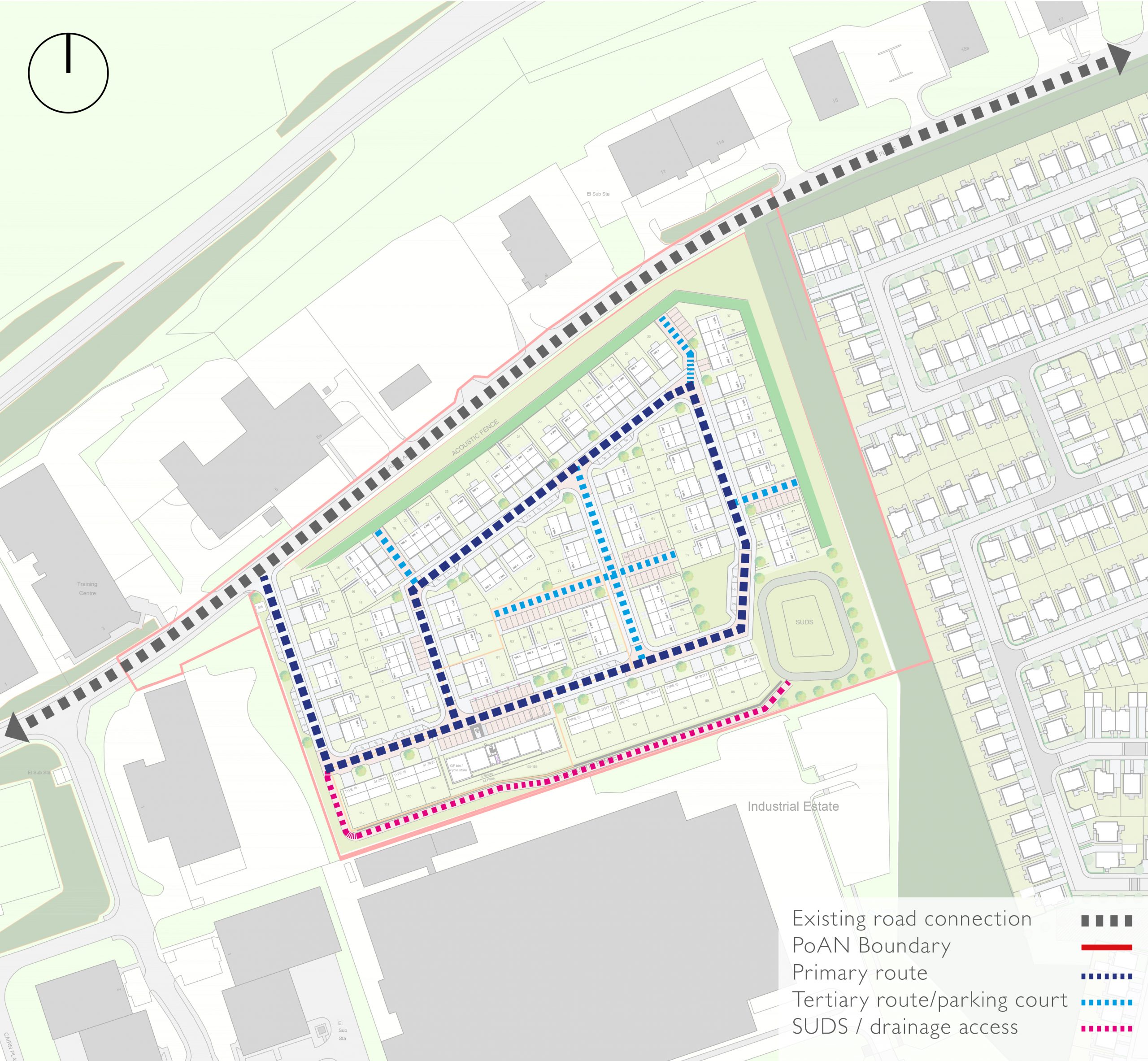
Vehicular Movement Diagram
Vehicular Movement
The primary vehicular access will be taken from Law Place to the north western corner of the site. From this, a 5.5m – 6m wide primary route, will form a loop road through the development. This will also provide access to secondary streets as well as shared drives and parking courts which allow access to housing around the perimeter of the site. In addition, an access track for the maintenance of SUDS and existing drainage will be created to the southern boundary.
Street design is reflective of the principles outlined within the Scottish Government’s Designing Streets policy, which states that streets should be ‘distinctive, safe and pleasant and easy to move around.’ Furthermore, the road structure will provide pleasant vistas throughout the site, informing a sense of place and aiding vehicular and pedestrian navigation. Road surface materials will also vary to provide character and definition between public and private realms.
Project Team

Cruden Homes – Applicant; EMA – Masterplanning & Design; Iceni Projects – Planning Consultant; Indev Consult – Engineers
Summary
The proposed development at Law Place, East Kilbride has the potential to be a vibrant and fully accessible new residential development on this long-standing brownfield site. The site is located in close proximity to a number of existing services, and will be able to conform with 20-minute neighbourhood aspirations set out in NPF4. The proposed development will include a range of private and affordable housing, including a variety of different housing types to cater to the needs of the local area. In addition, the site will be accompanied by a comprehensive new landscaping scheme, which seeks to assimilate the proposed development with the wider surrounding area, as well as providing biodiversity enhancement value.
Next Steps
Alongside the pre-application consultation exercise, the Project Team is progressing discussions with SLC and other stakeholders, and at present it is envisaged a planning application will be submitted in Autumn 2024. The planning application will be accompanied by a range of supporting information including transport, drainage, ground conditions, noise & vibration and ecology.
